Mt Kinabalu: Climbing Malaysia's highest peak
- chasing peaks

- Jan 11, 2024
- 9 min read
Updated: Jan 13, 2024
11 January 2020

Elevation - 4,095 masl
Elevation gained - 2,300 m
Distance - 17.4 km
Total time taken - 18 hrs (2 days)
Climbing period - March to September
Difficulty - 4/5 challenging (Endless uphill climbs at a high altitude!)
Trail type - Forest trails and steps in the lower sections and rocky terrains with some rope sections and rock scrambling towards the peak
Requirements - Permit, guide and a booking at the mountain lodge are required
Living in Southeast Asia, Mt Kinabalu is definitely one of the mountains to conquer on our list! At a height of 4,095 masl, Mt Kinabalu is the highest mountain in Borneo and Malaysia. Given its popularity, most climbing permits are snatched up well in advance and tours can be pretty pricey (up to SGD 1,000!). We actually booked our trip pretty last minute, about a month before the climb, and didn't have much time to properly train for it (I am pretty guilty about this). But on the bright side since it was during the off-peak period we got the tour package for alot cheaper. Do however note that going during off-peak season, there is the added risk of rain storms. The climb itself is challenging due to the long, arduous and seemingly endless climbs and at a high altitude. There are also strict cut-off times to adhere to get to the summit, so be sure to train sufficiently beforehand (don't be like me!). Having said that, the views are one of the most stunning and unique I have ever seen on a mountain (I don't think I need to describe this, just look at the photos)! This is also the last climb I did before COVID hit, which made it one of my most memorable climbs till date.
Trip Planning
It is compulsory to have a guide for the Mt Kinabalu climb and there are many tour packages available for you to book but do plan in advance as there are limited permits a days, which are very quickly booked up especially during the peak climbing season. We got our package from Amazing Borneo Tours for SGD 400+ per pax, which is considered cheap! But I can't recommend them, as our experience with them was not the best. There are 2 popular types of experiences available, the regular walking trail to Low's Peak, as well as a via Ferrata route (which I am too afraid of heights to attempt).
Costs
Tour Package - RM 1,300
(Including: guide, permit, transport to and from town, food during hike, mountain hut accommodation)
cost indicated is per pax
Getting There
The Tour included transport from our accommodation in town to the Kinabalu Park Headquarters for registration on the day of the climb, before the drive up to the start of the trail at Timpohan Gate.
Day 1 - Journey to the mountain hut
0600 | Depart from our Hotel |
0800 | Arrive at Kinabalu Park Headquarters for registration |
0900 | Start our climb from Timpohan Gate! |
1245 | Have our packed lunch |
1700 | Reach our rest hut at Panalaban for dinner and rest |
0600 | Depart from our Hotel
The driver up picked us up early on the day of the climb to set off to the Kinabalu Park Headquarters for registration. It was about a 2 hours journey, and though tired I was too excited to sleep on the ride.
1130 | Arrive at Kinabalu Park Headquarters for registration
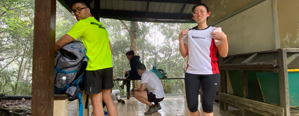
At the Kinabalu Park Headquarters we had to queue to register. There we were assigned a mountain guide and given a tag ID on a lanyard which was to be worn at all times during the climb. We were also given our packed lunch to be carried along and eaten during the climb. There was also a viewpoint where you can look out to Mt Kinabalu and internalise how daunting the climb is going to be! You can still see us with happy faces here, oblivious to the hardships ahead...
0900 | Start our climb from Timpohan Gate!
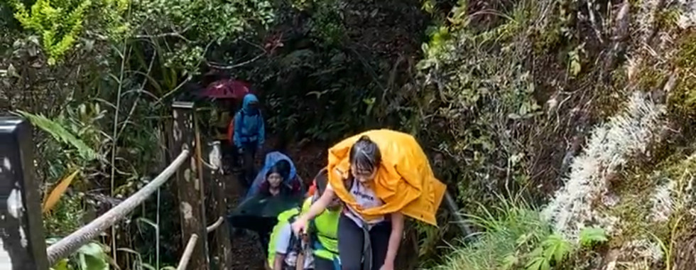
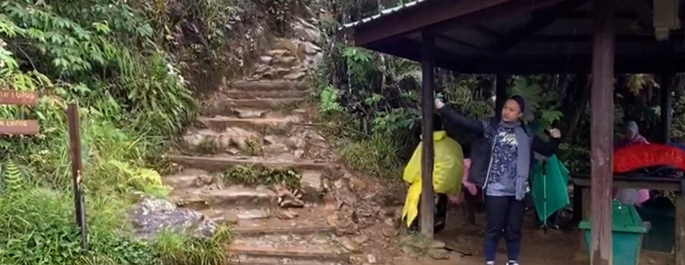
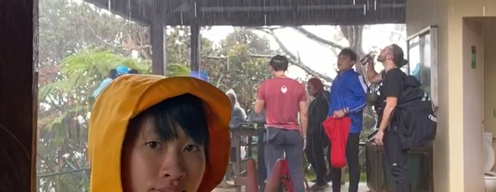
As I didn't own any hiking poles then, I rented one from the counter at Timpohan Gate, which came in really handy during the hike! So do rent one if you don't already have it. From the Timpohan Gate, we begun our hike with much optimism. The first section was a long downhill flight of steps. As you can see on the simplified map at the entrance, we had to pass by a number of huts before reaching our rest hut for the night - Panalaban. Although the trail looks deceiving straightforward on the map, the distance between each hut was pretty long, about an hour plus in between. I can never forget the excitement and relieve I felt every time we spotted a hut and could take a momentary rest. The trail was mostly uphill climbs along a dirt trail with steps held up by wooden planks (which I suppose helps with the soil erosion). It started raining not long into the hike, which definitely dampened our spirits and made the already tiring climb even harder.
1245 | Have our packed lunch
We finally sat down for a longer rest and to have our lunch close to 4 hours into the hike just as the rain started to get even heavier, at what I remembered was the Layang-Layang hut. And sad to say, though I was eagerly awaiting for lunch, the packed lunch provided by the tour agency was really sad - cold chicken breast, carrots and broccoli with no taste. They really just boiled the ingredients with no seasoning, not even salt and pepper. This had to be the worst food I have had on a climb, even a nutella sandwhich would have tasted so much better.
After the extended break with a disappointing lunch, we reluctantly picked up our backpacks and continued the uphill climb in the rain. About another hour in, we reached a section where we had to scramble up a steep slippery rock surface, this was made harder due to the rain. After a few rounds of precarious scrambling, we reached a clearing, where for the first time since we started the climb, we got to admire the breathtaking (literally) unobstructed view of the surroundings. We then did a short photo session, which was actually more an excuse to take a break.
1700 | Reach our rest hut at Panalaban for dinner and rest
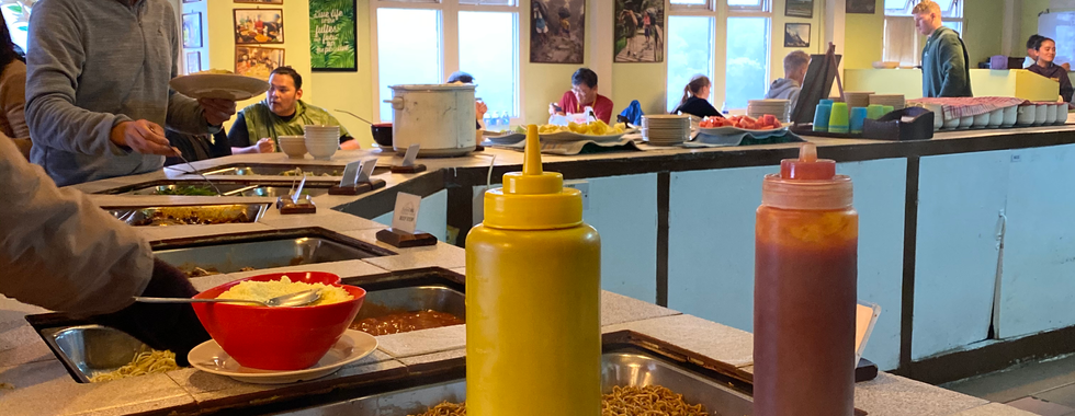
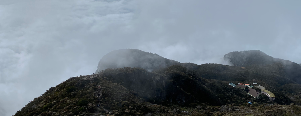
It was almost 5pm when we spotted the huge sign which read 'Panalaban', a good 8 hours since we started our hike that day. We were relieved to finally be able to rest our tired feet and souls after a long day of climbing. Stepping into the door of the hut we could hear the bustling of crowds within, happily chatting away and enjoying their meals. We were first shown to our rooms, a cosy dormitory with 4 bunk beds. After a quick wash up we eagerly went to the common dining area have our dinner. A huge contrast to the lunch we had, dinner was a tantalising buffet spread with a huge variety of food and even dessert options. We stacked our plates full and went ahead to stuff our faces. The simple meal somehow tasted so satisfying, partly due to the hard work put into the day's climb. We didn't catch the sunset that day as the rain did not let out and the weather was foggy. So we went to bed early that day, in preparation for the big summit climb the next day.
Day 2 - Summit for sunrise
0230 | Wake up for breakfast |
0330 | Begin our climb to the summit |
0700 | Reach the summit for a quick photo and descend |
1100 | Reach back to Panalaban hut |
1700 | Back to Timpohan Gate |
0230 | Wake up for breakfast
We woke up to get breakfast at 2.30am in the common dining area. There was porridge, bee hoon and egg, our fuel for the summit climb. I had experienced some AMS symptoms in the night, mostly headache, while another friend had more severe symptoms - fever. While we asked the guide for advice for AMS, he just said that if the symptoms persist we should descend. My headaches were better after awhile, while the friend took some panadol to help with the fever.
0330 | Begin our climb to the summit
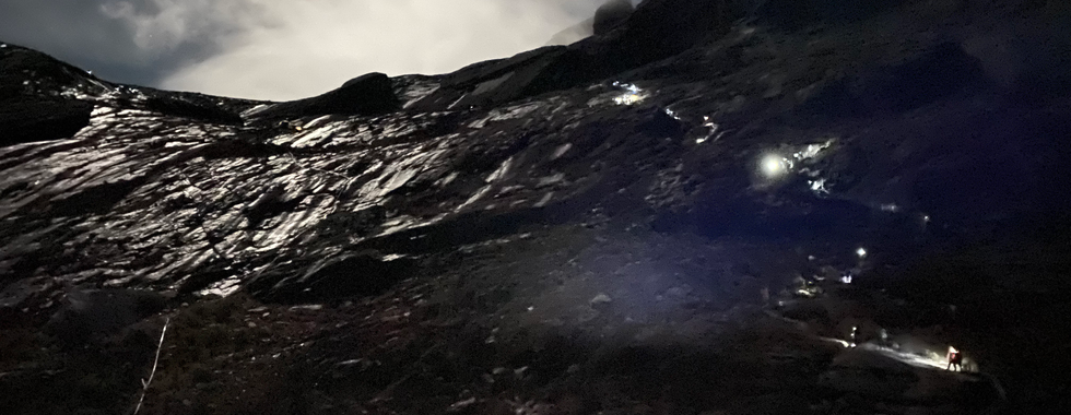
We begun our summit climb at around 3am in the dark. We couldn't see anything in the dark of the night except the steps immediately ahead. It was another round of climbs after climbs. Unlike the day before, I could definitely feel the effects of the high altitude during this summit climb, as I had to stop to catch my breathe every so often. It didn't help that the guide was rushing us, as there was a cut-off time to reach the Sayat-Sayat checkpoint by 5.30am, if not we will have to turn back immediately. I had honestly wished the guide would have let us start the climb earlier so we had more buffer time. Nonetheless, the tall mountain loomed ahead and we pushed on.
Luckily, we made it to the Sayat-Sayat check point in time, where they checked our ID tags one by one before letting us through. Just as we finally felt some relieve, the guide once again reminded us that there was a cut-of time of 7am to reach the summit, omg help I have never felt so stressed climbing a mountain! After the endless flights of steps were sloped sections with a rope to pull yourself up. We took turns to head up the sloped sections. It was not too steep, and I could manage without the rope on most parts. The sky started to light up as we finally reached the top of the silhouette of a mountain that loomed ahead. I had thought the climb was almost over, but just I crossed over the top, there was still a long slope and stretched far out. The guide pointed out to an elevated point in the distance and told us that was where we were heading - Low's Peak. Although the slope up was not exactly that steep, the air was thin, and I was huffing and puffing non-stop with every step. My sole focus was to put one leg in front of the other as we inched towards the summit.
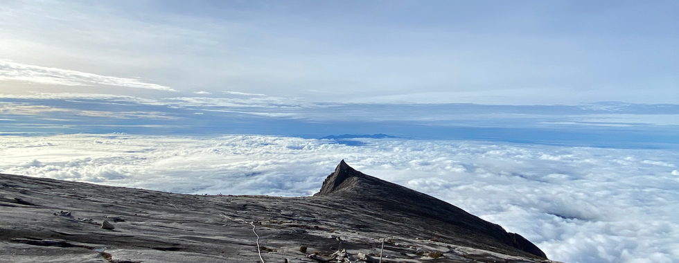
Whenever I stopped for a break, I would look back to enjoy the sunrise and the sea of clouds beneath us. As we near the peak, we had to scramble up to the last mile to the signboard. It took every ounce of my energy as climbed up on all fours, stopping after every few boulders to catch my breathe.
0700 | Reach the summit for a quick photo and descend
Finally standing at the summit and looking out in the distance, we couldn't believe how far we had come. I initially had doubts about making it to the peak, as I was still recovering from a flu. The scene in front of us looked surreal, as if we we were on another planet with Mt Kinabalu's unique rocky terrains. It was almost 7am, and the guide rushed us for a group photo, before we had to quickly descend. We didn't have much time to savour our achievement, before having to scramble back down the same rocky path. Most of the climbers we saw on the way, were already making their way back. Although we didn't make it to the peak in time for sunrise, the sunrise on the way was still beautiful.
On the way down we couldn't help but stop every few steps to take photos of the stunning views. The views were unlike another other mountains I had climbed - terrains of large rocky slabs against a backdrop of the sea of clouds and the puddles of water was also glistening in the morning sun. Although the rock sections were not too steep, my friend had slipped and fell as there were still some wet and slippery portions. We continued our climb down the slope section to reach the steps. The guide had pointed out some huge white boulders scattered here and there, which were remnants of the 2011 earthquake. A stark reminder that though beautiful, the mountains were still a dangerous place. In the light of the day, we could finally admire the views around us, which made the long descend much more enjoyable.
1100 | Reach back to Panalaban hut
It was 11am when we finally reached back to Panalaban hut. We took a group photo with the Panalaban sign and headed in to quickly pack out bags before checking out and continuing our way down. Like the day before, it started to rain as soon as we passed the hut. Likely because we are now below the clouds. We were just glad to have good weather on the summit. We clad ourselves in our rain coats once again, and walked through the flooded paths on the way down. The rain did not let up, and the steps became waterfalls. On the way down, my mind was mostly a blank, I was just focused on reacher the next lower hut and ignoring the pain in my knees (apparent with the lack of photos).
1700 | Back to Timpohan Gate
Although I don't have an accurate estimate on this, I suspect it was about 5 or 6pm when we finally arrived back at the Timpohan Gate. The last mile was a flight of steps up, and we were all limping up as our legs were barely functioning by then. The guide then brought us back to the Kinabalu Park Headquarters to wash up and collect our food before sending us to our accommodations in town. We were all given a certificate and medal for summiting Kinabalu. We were all still limping for the next one week after the climb, my legs just felt like solid concrete.
My Thoughts
I had honestly underestimated how hard Mt Kinabalu would be. While partly also due the last minute planning and having fell sick before the trip, I didn't get the chance to properly train up for it. Don't make the same mistake as me! Otherwise, the views on Mt Kinabalu totally blew my mind. They were unlike those on any other mountains, the surreal and stunning scenery was definitely out of this world. And for that alone, Mt Kinabalu was definitely worth a visit! But do be prepared for a challenging climb!


















Comments